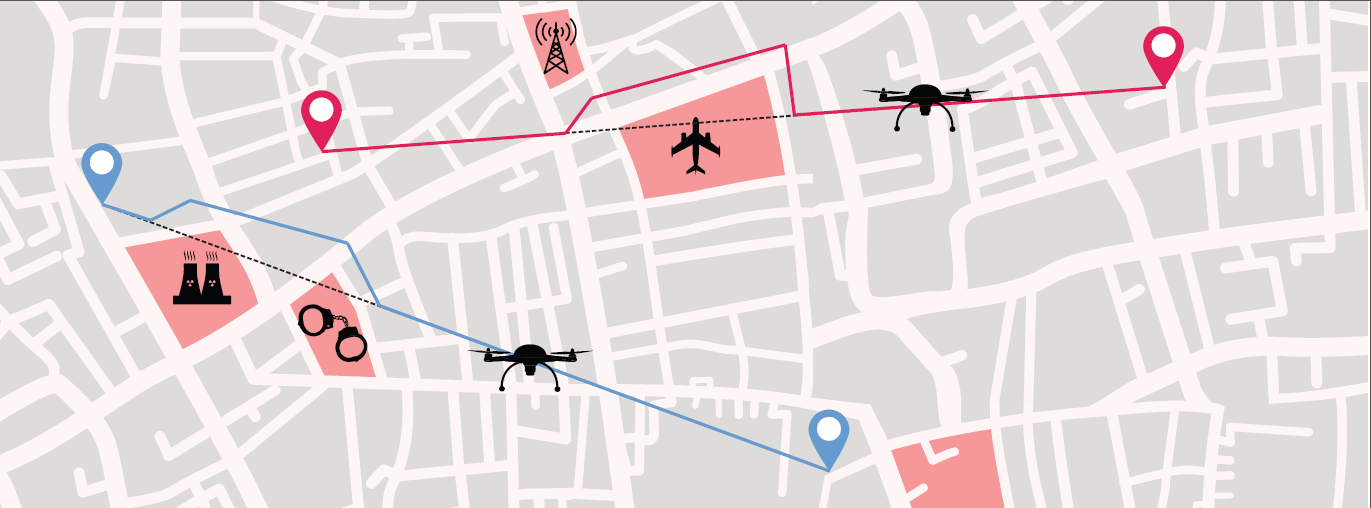
Principle of geofencing system
Latest News
 19 March 2019: Thales to lead EU project on drone geofencing technologies to secure future U-space. Read the press release
Participants:
| Thales | The coordinator of the project. Recognized as mastering the technologies needed for autonomous vehicles and a world-class leader in the fields of military drones, civil avionics and air traffic management, Thales is one of the pioneers of urban air mobility. As the coordinator of the project, Thales will organize all tests and will provide recommendations for the European geofencing system. |
| Aeromapper | Aeromapper is a manufacturer and operator of long range UAVs specialized in cartography and surveillance. Aeromapper provides Geosafe with test capabilities on fixed-wing drones for beyond line of sight flights. Aeromapper will work closely with AirMap and Thales to make Geofencing responsive and compatible with the future European UTM system. |
| AirMap | AirMap is the leading global UAS Traffic Management (UTM) platform for drones with solutions for geo-awareness, flight management, authorization, and real-time traffic deconfliction. For GEOSAFE, AirMap will equip each drone operation with dynamic airspace information related to advisories, regulatory requirements, and weather conditions. Once airborne, the drone shares telemetry with the AirMap platform to receive real-time alerts of changes in airspace conditions, including temporary flight restrictions, restricted areas, and live positioning of nearby air traffic for enhanced situational awareness and safety. |
| Airmarine | AIR MARINE has been performing air missions for more than 25 years. AIR MARINE’s combination of airplane/helicopter and drone commercial pilots allow the company to address accurately and efficiently the drone operational challenges with the manned-aviation related concerns. AIR MARINE will bring to GEOSAFE project its experience in multiple drone systems fleet operations to challenge and test in real flight conditions the performances of the geofencing features provided by the drone manufacturers. |
| ATechsys | Atechsys Engineering (ATE) provides a drone powered solution for 10 years. With Thalès and Hionos, ATE will be in charge of tests, in flight, of the Geosafe solution performances developed by partners. The CEEMA, sub-contractor of ATE, will give access to its privatized aerial zone with a runway. |
| SPH Engineering | Unmanned systems integration services and software development, and world’s premier mission planning software UgCS are the main specialization of SPH Engineering. As one of the partners of the project SPH Engineering will provide respective testing of geofencing solutions to validate the compliance of the current drone features regarding to U-space services. Tests will be performed in Latvia. |